Mobile phone signals

Page 2 - Passionate about caravans & motorhome? Join our community to share that passion with a global audience!
Mar 14, 2005
18,862
4,102
50,935
GPS only allows you to identify your position on the earth in terms of coordinates. It does not plot it on a map. The plotting of your position is done by the satnav unit which has to have access to map information to be able to display it.

Sat navs either have mapping data built in to them, or it may be necessary to have the mapping data on a memory card that you plug into the unit. Some units can also have a database which incorporates or can Of Interest (POI's) There are many different POI data sets which can be obtained for covering all sorts of POI's.

Unlike pure satnav devices, above, Smartphones don't have to have the map or POI data sets stored in them, they can use their ability to connect to the internet to use online mapping and POI databases to provide the image you see on them. Some systems allow you to download the relevant area of the mapping data to your phone if your likely to loose internet connection.

The GPS signal is entirely separate to the Internet signals (i.e. G3, G4 and G5 used by mobile phones)
 
Mar 14, 2005
18,862
4,102
50,935
There's a new Ofcom web site that is supposed to be more accurate in giving the signal coverage across the, currently 4, networks.


Of course if you have no signal on your phone you wont be able to use it :)
According to all the mobile signal strength notices, I live in a high strength area. Yet I struggle to get a useable signal at home except right by my front door, move a couple of feet away and its gone! The signal strength plots do not provide accurate information about small localities. All they can show is the location and power of the transmission towers. To be fair things have improved over last 10 years but its still quite patchy and sensitive to very local conditions.
 
Nov 11, 2009
24,003
8,398
50,935
  • Haha
Reactions: Dustydog

JTQ

May 7, 2005
3,870
1,597
20,935
Beginning to think the good old road atlas needs more usage🤔
Still do, but these days where effectively I drive and navigate, its too challenging and would be very dangerous if done together.
My wife had been a very good navigator, in car and rambling, and very much a paper map user, but those attributes have been robbed from her with aging.
Whilst there are attributes to navigating with paper mapping, it does not have the included facility of knowing where you are and the traffic conditions further on route that the better satnavs bring. Certainly with paper mapping the route option can be seen and decisions made, like potentially pretty, fastest & best for towing etc.
From that we made some super calls finding minor road routes both here and on the continent that brought some of the most memorable, for the right reasons trips. Seeing locations which to us had great appeal but would never have been found with a routing based solely on sat navs
 
Nov 11, 2009
24,003
8,398
50,935
I’ve still got a supply of A-Z city street maps. In ‘olden days” they were our GO-TO. info source whenever going to an unfamiliar address in local towns, or new towns never visited before. Supplemented with hand written directions on a series of postcards perched on the dashboard. Not much use on the motorbikes though.
 
Jun 20, 2005
19,448
4,894
50,935
I’ve still got a supply of A-Z city street maps. In ‘olden days” they were our GO-TO. info source whenever going to an unfamiliar address in local towns, or new towns never visited before. Supplemented with hand written directions on a series of postcards perched on the dashboard. Not much use on the motorbikes though.
20 years ago I probably had an A-Z or similar street plan map for every city and town in the U.K. Sat nav’s have probably made us all a tad lazy?
I suspect road signs were also more informative than they are today😉.

And yes I can say our Springers had built in homing devices. Always got us back to the caravan and car👍

Reading the Prof’s last post does a decent Sat Nav need GPS and Phone signal to function ?
 

Mel

Moderator
Mar 17, 2007
6,013
2,034
25,935
I’ve looked at the CAMC Avtex model which is apparently a Garmin🙀.


Beginning to think the good old road atlas needs more usage🤔

We have one of those Avtex jobs. Hardly use it. Got rather put off when we had set it up for towing and we’re still driving on local and familiar roads. It wanted us to go one way but we knew there were roadworks so chose to go on a different, slightly longer but perfectly towable route. Avtex did not like this at all and told us to turn left. This was up a hairpin turn onto a narrow single track lane that I would not have attempted solo; never mind with a van the back.
We use Google maps with me cross referencing with site instructions and sticking with site instructions when these differ. Also have an AA road atlas book for back up.
Mel
 
Nov 11, 2009
24,003
8,398
50,935
20 years ago I probably had an A-Z or similar street plan map for every city and town in the U.K. Sat nav’s have probably made us all a tad lazy?

Reading the Prof’s last post does a decent Sat Nav need GPS and Phone signal to function ?
My Garmin uses its inbuilt database and gps to function, and it does that very well. It also has the facility to pick up traffic alerts and offer options if required. It can do that via its power lead acting as an aerial but also has the facility to use an auxiliary aerial too.. But it doesn’t need a mobile phone signal. It’s a few years old now and is the Garmin 61LMTD with lifetime maps. I could also use Garmin software to input my required route when towing via the home computer. Develop the route required then export it to the Garmin. It’s positively ancient by modern tech standards so I guess new ones carry even more “ must have functionality such as Tik Tok, Instagram etc etc.


View: https://www.youtube.com/watch?v=2U_0HuFq1lQ
 
  • Like
Reactions: Dustydog
Jul 23, 2021
970
913
5,135
I had a Garmin U2 satnav for a while. Worst satnav ever, all the streets had no names. One time I spent three hours driving round town and I still hadn't found what I was looking for.
Is that the one where you vow to the sat nav to there there with or without you?
 
Jul 23, 2021
970
913
5,135
Google maps like Apple Maps uses gps to navigate, but doesn’t it require a mobile signal to search for POI? My satnav has very few useful POI within its own data base. For example a full Toyota software update is 8 gb, Wheras my previous Kia satnav and my Garmin require 32gb. So the extra 24 gb is significant wrt the data installed in them. I’ve used external sites for POI like I could use CMHC or CCC POi of interest to input them to my Garmin, but not sure that my Toyota system is compatible with inputting externally sourced data.
Google maps needs GPS for your location. It needs a map to navigate (plot a route) and the map comes with all the POIs that google knows about embedded (businesses, fuel stations, car chargers, pubs, coffee shops, bus stops and routes, A&E departments the list goes on and on). If you have dowloaded a map of an area for off line use, you have all of that on your phone so no data link is needed to either find a POI (google a coffee shop) or plot a route to it. Google will automatically cache places that you have navigated to or through, but you can explicitly tell it to download an offline map for backup.

On you device - tap your avatar icon (top right), tap "offline maps" and "select your map". you define the area and it will tell you how big it will be to download on your phone.
 
  • Like
Reactions: otherclive
Jul 18, 2017
15,581
4,854
50,935
Google maps like Apple Maps uses gps to navigate, but doesn’t it require a mobile signal to search for POI? My satnav has very few useful POI within its own data base. For example a full Toyota software update is 8 gb, Wheras my previous Kia satnav and my Garmin require 32gb. So the extra 24 gb is significant wrt the data installed in them. I’ve used external sites for POI like I could use CMHC or CCC POi of interest to input them to my Garmin, but not sure that my Toyota system is compatible with inputting externally sourced data.
If Google maps use GPS, then Waze will also use GPS as it is part of Google except that it is supposed to give you traffic info etc. We have not used the Yaris on a long run so unsure. Once I find out how to get it working on the Lexus, I will try it. On the Lexus it needs the cable connection plugged into the USB socket under the phone charger in the centre consol. Too hot to sit in the ca rand fiddle with it.
 
Jul 18, 2017
15,581
4,854
50,935
20 years ago I probably had an A-Z or similar street plan map for every city and town in the U.K. Sat nav’s have probably made us all a tad lazy?
I suspect road signs were also more informative than they are today😉.

And yes I can say our Springers had built in homing devices. Always got us back to the caravan and car👍

Reading the Prof’s last post does a decent Sat Nav need GPS and Phone signal to function ?
Definitely the Satnav does not need a phone signal to operate otherwise Satnavs would be useless. However by the same token I have no idea how traffic alerts operate i.e. road blocked ahead and would you like to use an alternative route. Obviously the alternative route is calculated by the Satnav using GPS and not the Internet.
 
Nov 11, 2009
24,003
8,398
50,935
Definitely the Satnav does not need a phone signal to operate otherwise Satnavs would be useless. However by the same token I have no idea how traffic alerts operate i.e. road blocked ahead and would you like to use an alternative route. Obviously the alternative route is calculated by the Satnav using GPS and not the Internet.
It is picking up road traffic information from the same FM networks that send traffic alerts to your radio.

 
  • Like
Reactions: JTQ and Buckman
Jul 18, 2017
15,581
4,854
50,935
It is picking up road traffic information from the same FM networks that send traffic alerts to your radio.

Thanks. On more than one occasion no alert on the radio, but Satnav has posted alert. Not sure how the radio alert works as it will need to pass the GPS location of the incident to the Satnav to alert the Satnav to offer an alternative route.
 
Nov 11, 2009
24,003
8,398
50,935
Thanks. On more than one occasion no alert on the radio, but Satnav has posted alert. Not sure how the radio alert works as it will need to pass the GPS location of the incident to the Satnav to alert the Satnav to offer an alternative route.
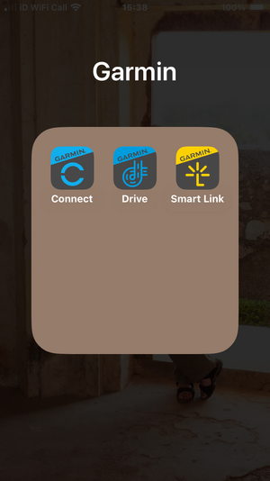
Mine doesn’t need a smart phone connection to give traffic information and re route options. But as I mentioned in an earlier post by today’s standards my Garmin is ancient and the information it provides is slower and more limited than later models. But it does have certain Bluetooth functionality with a phone if I require. See screenshot. Newer ones talk to the smartphone via a Garmin Live Traffic app which collates lot more information and outputs it to your device very quickly. But my Toyotas does that when it has a mobile signal and gives a detailed list ion of options. But my original post was about POI when no mobile signal is available.Although when we set off for home in the Lakes the council had decided that day to do major road works at Newby Bridge. Result very long tailbacks up to 3 miles. My cars satnav was slow in picking that one up due to poor signal in the locale. Once in the jam I got a wealth of info. 😂

IMG_3884.png
 
Last edited:
Jul 18, 2017
15,581
4,854
50,935
But my original post was about POI when no mobile signal is available.Although when we set off for home in the Lakes the council had decided that day to do major road works at Newby Bridge. Result very long tailbacks up to 3 miles. My cars satnav was slow in picking that one up due to poor signal in the locale. Once in the jam I got a wealth of info. 😂
You do not need a mobile signal to set a POI.
 
Mar 14, 2005
18,862
4,102
50,935
Just for your information, different systems use different methods to set a POI, some may allow the selection of a POI from a stored data base on the smart phone, whilst others have to rely on an internet connection to retrieve the data from a cloud based server.

Each manufacturer will choose which method to use.
 
Jul 18, 2017
15,581
4,854
50,935
Just for your information, different systems use different methods to set a POI, some may allow the selection of a POI from a stored data base on the smart phone, whilst others have to rely on an internet connection to retrieve the data from a cloud based server.

Each manufacturer will choose which method to use.
That may be so, but I am not aware of any Internet based system that supplies co-ordinates relating to yourself on the move as in some areas no mobile signal?
 

TRENDING THREADS

Latest posts